Viewpoint
Mount Victoria, Auckland
📍 Mount Victoria, Auckland, Auckland, New Zealand
No photos yet
4.3/ 5.0
★★★★☆
Quick Facts
- Location
- New Zealand, Auckland
- Category
- Viewpoint
- Duration
- 1-2 hours
- Ticket Price
- Free
- Address
- Mount Victoria, Auckland, Auckland, New Zealand
- Coordinates
- -36.8300, 174.8000
Introduction
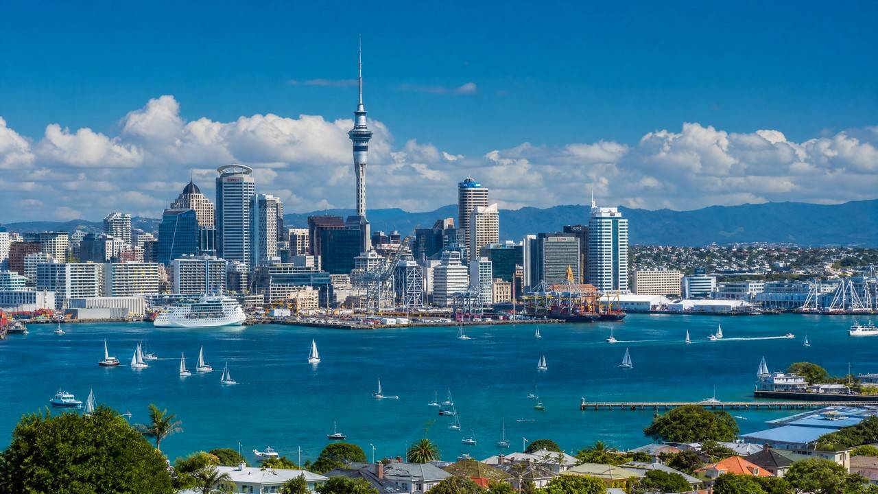
Mount Victoria (Takarunga in Maori), at about 87 m on the Devonport peninsula, is the highest point of Auckland's North Shore. The summit simultaneously frames Rangitoto, the gulf, downtown Auckland and the Harbour Bridge; 19th-century gun emplacements survive on the cone, and dusk is the classic hour for city panorama shots.
✨ Highlights
1
North Shore high point
An 87 m cone with 360° city views.
2
Harbour panorama
Rangitoto, the bridge and downtown in one frame.
3
Gun emplacements
19th-century coastal defence ruins.
🛈 Practical Info
→Location:Mount Victoria, Devonport, Auckland, New Zealand
→Time needed:About 1 hour
→Ticket Information:Free
💡 Tips
• Head up an hour before sunset for the day-to-night transition.
• The summit is windy — dress for it.
• A gentle 15-minute path reaches the top.
FAQ
How much is the admission for Mount Victoria, Auckland?
Free
Any practical tips for visiting Mount Victoria, Auckland?
Head up an hour before sunset for the day-to-night transition. The summit is windy — dress for it.
How long should I spend at Mount Victoria, Auckland?
A typical visit takes 1-2 hours.
Information compiled from public sources; opening hours and schedules may change, please verify with official sources.