must-visit in VikNational Park & Nature

Dyrhólaey

📍 Dyrhólaey, Vík í Mýrdal, Iceland
Dyrhólaey
1 photos
4.7/ 5.0
★★★★★

Quick Facts

Location
Iceland, Vik
Category
National Park & Nature
Duration
45-90 minutes
Address
Dyrhólaey, Vík í Mýrdal, Iceland
Coordinates
63.4194, -19.0097

Introduction

Dyrholaey is a 120-metre promontory about 20 km west of Vik on Iceland's south coast, its name meaning 'the hill with the door-hole'. It began as a volcanic island born of an undersea eruption at the end of the last ice age, later joined to the mainland by drifting sand. The Atlantic has cut a natural arch roughly 43 metres wide through the cliff base, large enough for small boats in calm seas and, in 1993, for an Icelandic pilot flying through. At the summit stands a square concrete lighthouse from 1927, automated in 1978. From the top the view runs east to Reynisfjara and the Reynisdrangar stacks, north to the Myrdalsjokull ice cap over the Katla volcano, and west along an unbroken line of black sand to the Westman Islands. A protected nature reserve since 1978, the upper area closes overnight from about mid-May to late June so puffins and Arctic terns can nest, and daytime hours are often limited to 09:00-19:00, so check the signs at the entrance before you go.

✨ Highlights

1
The 43-Metre Sea Arch
The Atlantic has cut a doorway roughly 43 metres wide through the cliff base; small boats pass through in calm seas and an Icelandic pilot flew through in 1993.
2
The 1927 Lighthouse
A square concrete lighthouse with an orange cap crowns the headland, automated in 1978 and still flashing white to sea every ten seconds.
3
A Volcanic Island's Story
The headland began as a volcanic island from an undersea eruption at the end of the last ice age, same origin as Surtsey, and only later joined the mainland by drifting sand.
4
A Four-Way Panorama
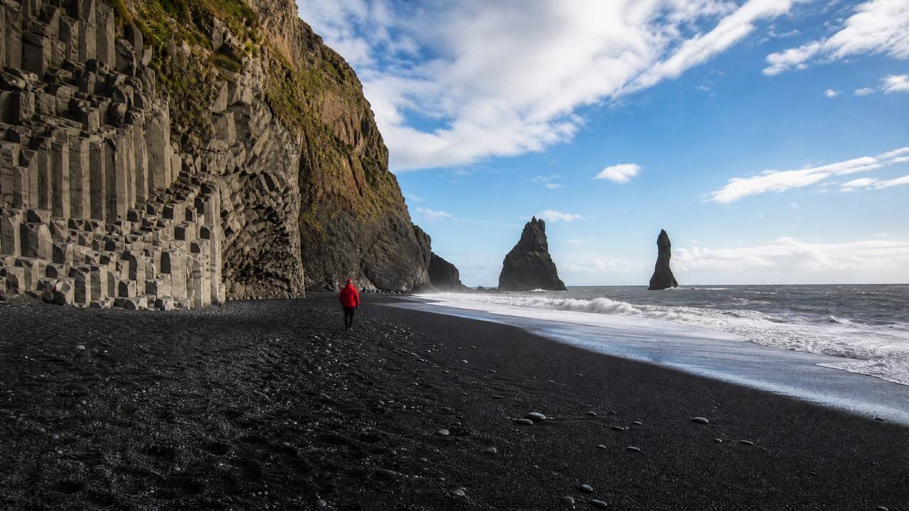
East to Reynisfjara and the sea stacks, north to the Myrdalsjokull ice cap over Katla, west along black sand to the Westman Islands: one of the south coast's widest views.
5
Puffin and Tern Nesting Grounds
A nature reserve since 1978; the grassy ledges host nesting puffins and Arctic terns, which is why the upper area closes for part of every spring.
6
Two Viewing Levels
An upper area by the lighthouse and the great arch, a lower one over Kirkjufjara beach and the Arnardrangur stack, about 1.3 km apart on foot.

🛈 Practical Info

→Duration:45-90 minutes; allow about 1.5 hours if you walk between both car parks, roughly 2.6 km return with a steady climb.
→Facilities:No cafe or shop on site. Toilets near the lower car park in summer, about 200 ISK; all other services are back in Vik.
→Best Time:Late summer evening gives the softest light, and puffins and terns are most active early morning and dusk. During the nesting closure you cannot be up there for sunrise.
→Worth it?:Yes. One of the few free south-coast viewpoints combining sea arch, lighthouse, black beach and glacier, and an easy detour off Route 1. For the arch alone the lower platform is enough.
→Watch out:Most of the rim has no barrier and the wind is far stronger than at road level; hold hats and cameras. Arctic terns dive at intruders, so keep clear of nesting areas. Download Parka before arriving.
→Opening Hours:Open year-round; upper area closed overnight 19:00-09:00 from about mid-May to late June, daytime often 09:00-19:00
→Transportation:Turn off Route 1 onto Road 218, about 20 km and 20 minutes west of Vik. The final stretch is steep gravel; a 2WD car is fine slowly in summer, often closed by ice in winter.

Ticket Information

Ticket Information
AdultFree

Free entry. Both car parks charge about 750-1,000 ISK via the Parka app or on-site machines, one payment covering upper and lower in the same visit; toilets about 200 ISK.

💡 Tips

• Do not feed puffins or approach burrows; use a telephoto, and expect Arctic terns to dive at you.
• The upper platform has the arch and lighthouse, the lower one the black beach and lone stack, about 1.3 km apart on foot.
• On windy days secure hats and drones, and use a camera wrist strap.
• During the nesting closure the upper area shuts overnight, so do not plan around long summer daylight.
• One parking payment covers both car parks; drive up first and walk down to save effort.
• Pair it with Reynisfjara and Skaftafell for a south-coast day, but note there is no road between them.

FAQ

What are the opening hours of Dyrhólaey?

Open year-round; upper area closed overnight 19:00-09:00 from about mid-May to late June, daytime often 09:00-19:00

How much is the admission for Dyrhólaey?

Adult: Free; Free entry. Both car parks charge about 750-1,000 ISK via the Parka app or on-site machines, one payment covering upper and lower in the same visit; toilets about 200 ISK.

Any practical tips for visiting Dyrhólaey?

Do not feed puffins or approach burrows; use a telephoto, and expect Arctic terns to dive at you. The upper platform has the arch and lighthouse, the lower one the black beach and lone stack, about 1.3 km apart on foot.

How long should I spend at Dyrhólaey?

A typical visit takes 45-90 minutes.
Opening hours, parking fees and the nesting-season closure follow south.is and on-site signage; information compiled October 2026. Stay well back from unbarriered cliff edges.