🌏 Destination Overview
Panama is famous for the Panama Canal that crosses its isthmus. Standing by the Miraflores Locks and watching giant ships slowly cross between two oceans is an awe-inspiring engineering marvel. Panama City's modern skyline faces its colonial old quarter across the bay; the San Blas Islands are guarded by the indigenous Guna people, with clear waters and coconut islets like a world apart, while the Boquete highlands scent the air with coffee. A blend of canal wonders, Caribbean islands and city life, it is a multifaceted destination in Central America.
🗓️
Best Season
Dec-Apr (Dry season)
🕐
Recommended Days
6-9 days
👪
Best For
Couples / Families / Culture Lovers
🎯
Top Activities
Canal · Islands · Old Towns · Coffee
🧳
Pre-trip Preparation
Visa/visa-free + sun protection
Popular Cities

Panama City
Capital,Canal,Metropolis
🔥 Canal wonder and modern skyline coexist with a colonial old town.
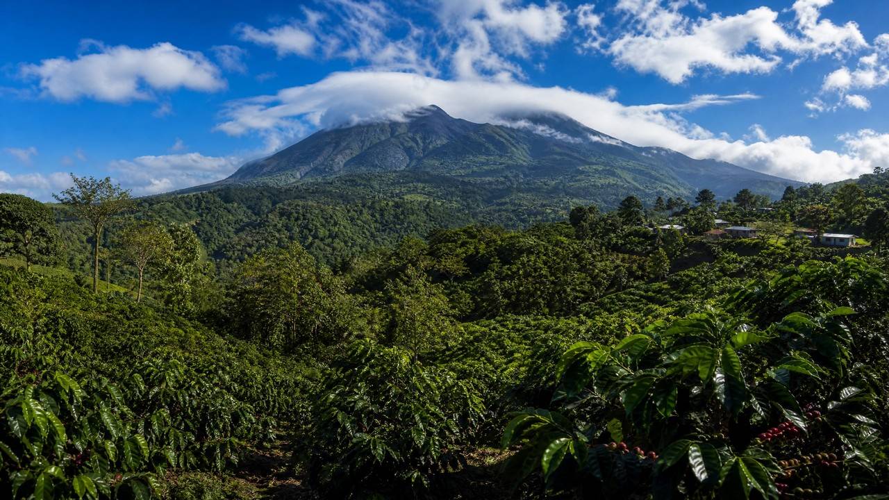
Boquete
Highland,Coffee,Hiking
🔥 Highland coffee heartland and hot spring hiking town.

David
Gateway,Highland,Western
🔥 A western gateway city en route to the Boquete highlands.
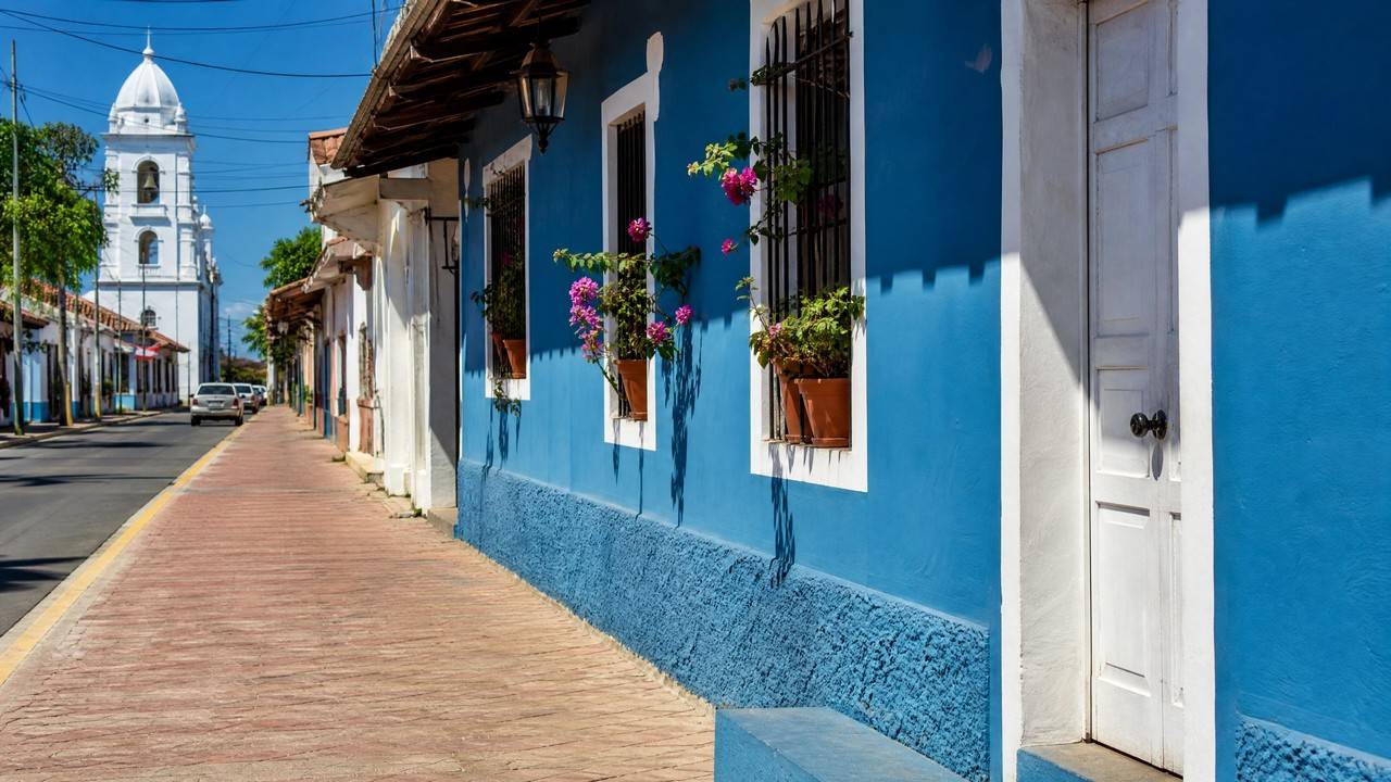
Pedasi
Waterfront,Surfing,Tranquil
🔥 A quiet surf town on the Pacific coast.

Portobelo
Old Town,Caribbean,UNESCO
🔥 A colonial fort World Heritage Site on the Caribbean coast.

El Valle
Volcanic Crater,Valley,Nearby
🔥 A valley town inside a volcanic crater, with hot springs and markets.
Popular Attractions
More Attractions →
Casco Viejo (San Felipe)📍 Panama City
San Felipe, the old quarter known as Casco Viejo or Casco Antiguo, is the historic district of Panama City, set on a peninsula cut off by the sea.
Why this old town exists: Panama City was founded on 15 August 1519 as Panama Viejo. In January 1671 the pirate Henry Morgan attacked and looted the city, and the governor Juan Perez de Guzman had it set on fire before the enemy arrived rather than let it fall into their hands, so the old city was almost totally destroyed. The new city was formally founded on 21 January 1673 on a peninsula completely isolated by the sea and ringed by a defensive wall system.
Form and change: three large fires in the eighteenth century altered the original layout, and the configuration you see today dates from the late nineteenth and first half of the twentieth century. That rebuilding inserted neoclassical and Afro-Antillean buildings among the ruins and colonial ones, which is what distinguishes it from old towns like Cartagena and Quito that are almost exclusively colonial.
Heritage status: inscribed on the World Heritage List in 1997 under the official name Archaeological Site of Panama Viejo and Historic District of Panama, reference 790, and extended in 2003. Note that this one inscription covers both the 1519 city ruins and the 1673 Casco Viejo: two halves of one property, not two separate sites.
Three details worth stopping for: the Arco Chato of the Santo Domingo convent, a flat arch that has stood for centuries without support and the most recognisable architectural detail in the quarter; the golden altar of the Iglesia de San Jose, which local tradition says was painted black and hidden to keep it out of Morgan's hands; and the Plaza de Francia, laid out in honour of French efforts on the canal and one of the best resting places on the seaward side.
Gentrification, which you should know about: the district has undergone marked gentrification in recent years, with restaurants, boutique hotels and nightclubs arriving in numbers and tourist pressure rising sharply. That has brought restoration money and commercial energy, along with the displacement of original and lower-income residents. It is a historic district and a community still changing.
Practical: the district is open at all hours and free to enter, half a day covers it on foot, dusk into night is the best atmosphere with rooftop terraces looking across at the new city's skyline, and after dark stick to main streets and lit routes while keeping phones and belongings close.

San Blas Islands📍 Panama City
The San Blas Islands, officially Guna Yala, lie off Panama's northeast Caribbean coast near the Colombian border, made up of more than 365 coral islets under the Guna Yala indigenous comarca.
This is not an ordinary island resort: the islands belong to the Guna people, formerly Kuna, and the Guna General Congress governs tourism, issues the entry permits and licenses the operators, while the territory runs on its own rules. No road, ferry or commercial airline reaches the islands, and every visit has to be arranged through a Guna-approved operator or host. You come as a guest, not a customer.
Fees (2026): foreign visitors pay a US$20 entry tax in cash at the Carti checkpoint or the first island, collected by Guna authorities rather than the Panamanian government; Carti port adds about 2 dollars, and each island charges a further 2 to 5 dollars, so the fees come in stages.
There are no ATMs anywhere in the comarca, so bring all your cash from Panama City, and 50 and 100 dollar notes are often refused, so carry small bills. Your original passport is required and will be checked.
Getting there: pickup from your Panama City hotel between 5:00 and 5:30, a 4x4 drive of about two to three and a half hours over the Continental Divide to Carti port, then 20 to 40 minutes by lancha, roughly four hours door to door. The road to Carti needs a high-clearance 4x4, and rental companies prohibit ordinary cars from it. The alternative is a charter from Albrook's domestic terminal, about 45 minutes and roughly 400 dollars one way.
Two nights minimum: a day trip is technically possible, but three hours each way buys about five hours on the islands, leaving you exhausted with only a superficial look. Most trips run two to four nights from one island base, with thatched cabanas at about 80 to 130 dollars a night including three simple meals.
The Guna Congress bans scuba diving in the comarca, so only snorkelling and free-diving are possible.
Behavioural rules you must follow: ask permission before photographing any Guna person, and never photograph women without explicit consent; photographing military and government installations is prohibited throughout; ask before setting foot on inhabited islands; pack out all waste; light alcohol use is allowed in most tourist cabanas, but nudity and topless sunbathing are not.
Luggage: soft-sided duffel bags only, since large hard-shell suitcases are almost impossible to stow.
Season: December to April brings the calmest seas and best visibility, with January to March peak and booked early, and October to November the wettest. The real risks are logistical, namely rough crossings, sun exposure and the absence of medical facilities, so take out travel insurance that covers medical evacuation.

Amador Causeway📍 Panama City
The Calzada de Amador is a long causeway running out into the Pacific on the west side of Panama City, starting from the land near the Ancon district and linking four small islands in sequence, Naos, Culebra, Perico and Flamenco.
The causeway is made of rock dug out of the canal. Construction began in 1913 using spoil from the Culebra Cut, also called the Gaillard Cut, the hardest section of the canal. Engineers needed somewhere to dump millions of cubic metres of excavated material, and the result, entirely by accident, became one of the most scenic waterfronts in Central America. A later expansion used spoil from the 2016 canal widening project, so it is built from the physical remains of two generations of canal history.
Two things usually got wrong.
First, its length has never been officially published: tourism authorities say about six kilometres, other sources give four or eight, and the canal authority does not state one at all, the gap coming from different parties measuring different sections.
Second, it is four islands, not three. Many sources list only Naos, Perico and Flamenco and leave out Culebra, because Culebra has effectively merged with Naos and the Smithsonian's Punta Culebra Nature Center sits on it. The canal authority's official count is four.
Military past: from 1920 to 1980 these islands formed part of Fort Amador, a US military installation that with Fort Grant guarded the canal's Pacific entrance, and old gun emplacements and bunker remnants can still be found on the hillsides of Naos and Culebra. In 1999, as part of the canal transfer, the land returned to Panamanian sovereignty.
Access rules: free and open around the clock. This is a public road with pedestrian and cycling lanes, no gates and no ticket office.
Why the view is hard to replace: from the causeway you take in three things at once, the Bridge of the Americas, the canal's Pacific entrance with the ships at anchor, and the Panama City skyline across the bay. No second place in the city does that.
Three anchors along it: the Biomuseo at the start, designed by Frank Gehry and opened in 2014, Latin America's first museum dedicated to biodiversity, in the only Latin American country with a Gehry building; the Smithsonian's Punta Culebra Nature Center on Naos, with interactive marine exhibits and a dry forest trail; and Flamenco Island, the main hub with the largest marina, the ferry terminal and several restaurants, where boats to Taboga Island leave from.
Sequencing: put the museum first, while it is cool and before the last-admission cutoff, then rent a bike and ride out to Flamenco, lunch at the marina, and take the nature centre on the way back. There is almost no shade at midday, so carry water and sun protection.

Miraflores Locks📍 Panama City
The Miraflores Locks sit on the Pacific side of the Panama Canal in the Ancon district of Panama City, about twenty minutes' drive from the centre. They are the most accessible locks on the whole canal, because the visitor centre sits directly above them and you can watch a full ship transit from less than fifty metres away.
Engineering scale: this is a two-stage lock system, lifting or lowering a ship 16.5 metres across two chambers. Levels change by gravity-fed filling and draining, and the ship is eased along against the chamber walls by electric tractors on tracks known as mules, which stop it striking the sides. Nothing here pushes a ship with a motor: water and counterweight do the work.
The visitor centre has four floors. The ground floor is an interactive museum on the canal's history and construction, the second floor is an IMAX theatre showing a 45-minute film narrated by Morgan Freeman and included in the ticket, and the third and fourth floors are the observation decks. There is also a restaurant with canal views, a cafeteria and a gift shop.
The single most important timing detail: the ticket office runs 8:00-17:00 while the centre itself stays open until 18:00. That last hour is not a reliable walk-up window, so either buy ahead or leave enough margin before the counter closes.
Admission: non-resident adults B/.17.22, ages 6 to 12 B/.7.22 and under 6 free, while residents with valid ID pay B/.3.00. The balboa is pegged one to one to the US dollar and circulates alongside it, so the B/. figures can be read as dollars. The ticket covers all four decks, the museum and the IMAX.
Ships do not arrive by the minute: the locks release traffic on an operating schedule, so an empty lock is possible even during opening hours. The official visitor site posts the day's transit windows, so check the same morning before leaving your hotel. Peaks are 9:00 to 11:00, mostly northbound, and 14:00 to 17:00, mostly southbound, with 11:30 to 14:00 the quietest stretch.
If few ships come through, the IMAX film and the museum still carry the admission price, so the visit is not wasted.
For the expanded locks, go to Agua Clara on the Atlantic side instead, where you see the Neopanamax ships from the 2016 expansion.

Bocas del Toro📍 Santa Catalina
Bocas del Toro lies on Panama's Caribbean northwest coast near the Costa Rican border. The provincial capital and travel hub, Bocas Town, sits on Isla Colon, a Caribbean port town of wooden buildings on stilts over the water, with Calle 3 as the main strip holding the hotels, restaurants, dive shops and tour operators.
Movement: there are almost no roads between the islands. Isla Colon has paved roads into the interior, but Bastimentos, Carenero and the smaller islands are reached only by water, most commonly by panga water taxi, five to ten minutes and two to five dollars per person.
Currency, easily got wrong: Panama's legal tender is the balboa, but the balboa exists only as coins and no banknotes are printed, so what actually circulates is the US dollar. American cards work widely and ATMs dispense dollar bills directly.
Two attractions whose fame has outrun reality, which you should know in advance.
First, the starfish at Playa Estrella have declined sharply through uncontrolled mass tourism. Visitors ignore the written warnings and lift starfish out of the water onto the sand for photographs, and starfish breathe through their tube feet, so being out of water kills them. Recent reviews run both ways, from 'once plentiful, now countable on one hand' to still reporting good numbers, so lower your expectations.
Second, Playa Red Frog is named for the strawberry poison-dart frog, red-bodied and blue-legged, but recent reviews widely report the frogs are now hard to find, and 'we didn't spot any during our visit' is a common refrain. The beach kept its name while the frogs largely disappeared.
Never lift a starfish out of the water, and do not touch them in the water either.
What deserves priority instead is the Cayos Zapatillas, two uninhabited cays inside the Bastimentos Marine National Park and the best snorkelling in Bocas, at about 10 dollars entry for foreigners, with no bars or restaurants on the cays so you bring everything with you.
Season: annual rainfall is about 3,000 mm and locals call it nine months wet and three months dry. The relatively dry windows are February to April and September to October, and December to April brings the steadiest seas and best snorkelling at the highest prices and crowds, while the green season from May to November brings lusher jungle and better surf.
Cash: Bocas Town holds the archipelago's main ATMs and the smaller islands have none at all, so carry enough small bills.
Boquete
Boquete is a highland town in Chiriqui Province, Panama, set in a valley on the slopes of Volcan Baru at about 1,200 metres above sea level, spread along the Caldera River. Average temperatures run about 18 to 24 degrees C year-round, springlike throughout, which is why it is called the land of eternal spring.
Locals have a word for one specific weather condition, bajareque: a fine, wind-driven misted drizzle that is not quite rain, and the reason trails are soaked by two in the afternoon. It is also the reason geisha coffee thrives here.
The dry season, December to April, runs to a reliable rhythm: bright clear mornings, a cloud bank moving in over Baru around eleven, full mist and drizzle by mid-afternoon, and sometimes clearing again at sunset for a rainbow. So the itinerary runs backwards: put hiking in the morning and leave coffee fincas, museums, town wandering and long lunches for the afternoon. Bring a fleece and a rain shell even in February, since the wind off Baru at dawn can drop the felt temperature into single digits.
Volcan Baru, Panama's highest peak at 3,475 m: a dormant volcano whose last eruption is put at about five hundred years ago. What makes the summit special is that on a clear day it is the only point in the Americas where you can see both the Atlantic and Pacific oceans at once. The standard approach is to start at midnight for sunrise, five to six hours up, roughly 13 km round trip and seven to fourteen hours depending on fitness, though you can also drive partway up.
Geisha coffee: Boquete is one of the world's premier coffee regions, and the geisha varietal has repeatedly broken price records at international auctions, commonly quoted at over 100 dollars a pound, with higher figures of 1,600 dollars a kilo also circulating. The numbers move a lot year to year, so do not treat them as fixed.
Estates to visit: Finca Lerida, one of the oldest, with its own birding lodge and a full seed-to-cup experience; Kotowa with daily tours at about 25 to 35 dollars; Cafe Ruiz, a large operation with comprehensive tours; and Finca La Milagrosa, a smaller organic estate. Tours normally include a plantation walk, an explanation of processing methods, a cupping session, and the chance to buy beans at the source.
Birdwatching: a world-class birding destination whose star is the resplendent quetzal, most readily seen from December to May around Volcan Baru. Hiring a local birding guide, about 50 to 100 dollars for a half day, dramatically improves your hit rate.
Trails and hot springs: the 9.6 km Sendero de los Quetzales to Cerro Punta, about 5 dollars to enter and one of the finest hikes in Central America; the flat, species-rich Pipeline Trail; Lost Waterfalls, three cascading falls over two to three hours round trip; and the Caldera Hot Springs about thirty minutes from town at about 3 dollars.
Getting there: almost every route passes through David, the lowland capital of Chiriqui Province. David's airport, DAV, has daily flights from Albrook, PAC, in Panama City, about forty minutes in the air, and from the David terminal buses leave every twenty-five to thirty minutes, cost 1.75 to 2 dollars in cash to the driver and take fifty to sixty minutes up the only road in.
Orientation: the Caldera River cuts through town, and the main bridge over it is the most photographed spot in Boquete and the most useful reference point when getting your bearings.
Classic Experiences
Best Travel Seasons
🌤️
Dry season · Dec-Apr
Clear and dry, the best time
🌧️
Rainy season · May-Nov
Afternoon showers, lush greenery
📅
Transition · Apr-May
Entering rainy season; fewer crowds, better prices
📅
Year-round
Tropical climate; islands enjoyable year-round
The dry season (Dec-Apr) is sunny and dry, ideal; the islands are enjoyable year-round, and the rainy season brings mostly brief afternoon showers.
Popular Guide Articles
More →Practical Info
Depends on passport/departure country; check the latest visa and entry policy before travel
Panamanian Balboa (PAB), equal to USD; USD widely used
Panama time UTC-5; flight duration depends on departure city
SIM cards / eSIM, pocket WiFi and common travel apps
Intercity by domestic flights; islands by boat and small planes
Obey local laws, mind personal belongings; emergency 911 (general)
Free Consultation
Free Consultation
Tell us your departure city, travel dates and interests, and Zou Sifang will tailor a trip just for you.